STATE STRUCTURE
Provincial and local governments. Pakistan is a federation consisting of four provinces (Punjab, Sindh, North-West Frontier Province, Balochistan), the Islamabad metropolitan area, the tribal areas and the centrally administered Northern Areas. The highest official in the province is the governor, appointed and removed by the president. The provinces of Pakistan are divided into regions, which consist of districts, and the latter - of districts (tahsils), which unite a group of villages. (Appendix No. 5) Azad Kashmir. Part of the territory of the former Indian principality of Jammu and Kashmir, occupied by the Pakistani authorities in 1947, has a special status. In October 1947, the independent state of “Azad (Free) Jammu and Kashmir” was proclaimed here, which has political ties with Pakistan and is bound by the 1949 agreement. Currently, Azad Kashmir occupies an area of about 33 thousand square meters. km., where about 2 million people live. The capital is Muzaffarabad. Another about 50 thousand sq. m. km. administered directly by Pakistan. Pakistan has its representative in Azad Kashmir.
The governing bodies of Azad Kashmir are the Council (located in Islamabad and headed by the Pakistani authorities), the President, the Assembly and the government headed by the Prime Minister. The Constitution was adopted in 1974. President since 2001 is former General Muhammad Anwar Khan, Prime Minister is Iskander Hayat Khan. The activities of political parties that reject the connection between Kashmir and Pakistan are prohibited
President and Government of Pakistan. According to the 1973 constitution, the Islamic Republic of Pakistan is a federal state. The head of state and symbol of its unity is the president. He is considered the head of the executive branch, part of the legislative branch and the supreme commander of the armed forces. The President has the right to pardon, cancel and commute the sentence of any court.
In 2001, the military leader of the country, General Pervez Musharraf, became the president of Pakistan due to the suspension of the constitution. In 2002, the authorities held a referendum, as a result of which Musharraf was confirmed as president. The President again received the right to dissolve the country's parliament.
The highest legislative body of Pakistan is the parliament (Majlis-i-Shura), consisting of two houses: the lower (National Assembly) and the upper (Senate).
Administrative apparatus. Government agencies employ mostly professionals. Their upper stratum is formed by well-trained officials of the Pakistan Civil Service, which once included 1,000–1,500 people and was abolished in 1973 under Zulfiqar Ali Bhutto.
Armed forces. Thanks to assistance from the United States and several other countries, Pakistani troops are well trained and equipped with modern weapons. In 1998, the ground armed forces numbered 450 thousand, sea forces 16 thousand and air forces 17.6 thousand people. The army has always had enormous influence in the country. Generals often moved to high positions in the civil administration, actively participated in the political events of the country, declared a state of emergency and established control over the government
ECONOMY
General characteristics of the economy. Pakistan is an agrarian-industrial country in which the majority of the self-employed population is employed in agriculture. In 1991–1992, approximately 48% of the total labor force was concentrated in the agricultural sector, 20% in industry and 32% in the service sector. Unemployment and underemployment remain chronic problems. Many Pakistanis, from skilled professionals to ordinary workers, have to work abroad, especially in the Middle East. In 2002, Pakistan's GDP was $295.3 billion, or $2,000 per capita. 24% of GDP is created in agriculture, 25% in industry and construction, and 51% in trade and transport. In general, during the period of independence, undoubted economic progress was achieved: from 1947 to 1990, production increased its capacity by an average of 5% per year, but then the pace slowed down and in 1996–1997 was estimated at 2.8%. In 2001, the population at risk of poverty was 35%.
Agriculture. The country is heavily dependent on its agricultural sector to supply food and provide raw materials to industry. The main grain crop is wheat. The government buys it from farmers at a fixed price and subsidizes the sale of flour to the population. Government organizations are promoting the introduction of new high-yielding Mexican-Pakistani wheat varieties by distributing seeds to farmers at low prices, and also provide support in the purchase of pesticides to combat pests and plant diseases and mineral fertilizers.
Among commercial commercial crops, cotton is the most important. It is cultivated mainly on small farms, which supply raw materials to cotton ginning enterprises at government purchasing prices. These enterprises then sell the fiber to a government corporation, which sells it for export or to textile mills.
Leading food crops include rice, maize, chickpeas, sugarcane and millet. Rice is particularly important as an export commodity: the country's basmati variety produces an elongated, aromatic grain that is highly prized in the Middle East.
The country's agriculture relies on the most extensive irrigation network in the world. Flood filling channels, devoid of head structures that would guarantee water intake during low-water periods, already existed in the era of the early Indus Valley civilization. In the 19th and 20th centuries, under English rule, a system of permanently filled canals was created, which were fed by rivers all year round. Many peasants also build boreholes. In Pakistan, more than 80% of arable land is irrigated.
After the 1947 partition, some of the hydraulic structures that fed the canals in Pakistan ended up within India. The dispute over rights to river flow was resolved, with the participation of the World Bank as a mediator, by the signing of the Indus Water Treaty in 1960. According to this treaty, India received the right to control the flow of the Ravi, Beas and Sutlej, and Pakistan - over the flow of the Indus, Jhelum and Chenab. In the 1960s, a large earthen dam, Mangla, was built on the Jhelum River bordering India, and in 1976–1977, the Tarbela Dam on the Indus River.
Mining industry. Major gas deposits were discovered in Sui (Baluchistan) in 1952, followed by discoveries in Punjab and Sindh. Oil was first discovered in Punjab's Attock district before the First World War. There are currently 7 fields in operation, but they satisfy less than 10% of Pakistan's liquid fuel needs. Other identified mineral resources include coal, chrome ores, marble, table salt, gypsum, limestone, uranium ore, phosphate rock, barite, sulfur, fluorite, precious and semi-precious stones. A large deposit of copper ore has been discovered in Balochistan.
Energy. Energy consumption in the country is low and in coal equivalent is 254 kg per capita, i.e. about the same as in India. More than half of the electricity is generated at hydroelectric power plants, but thermal power plants are also important; the role of nuclear power plants is limited.
Manufacturing industry. In Pakistan, the most developed textile industry (production of yarn and fabrics from domestic cotton) and the production of clothing for export.
With the help of the Soviet Union, a metallurgical plant near Karachi was built and put into operation in 1980. The capacity of the cement and sugar industries is being increased, and several oil refineries are operating. Natural gas serves as a raw material base for the chemical industry, in particular the production of fertilizers, and is used as fuel for thermal power plants.
Small-scale industries, such as sports goods (footballs and other balls, hockey sticks) and surgical instruments in Sialkot, play an important role in Pakistan's economy. There are numerous small cotton weaving enterprises operating in the informal sector of Faisalabad and other cities. In a number of Punjabi settlements, workshops sprang up for the manufacture of agricultural implements, pumps and diesel engines. Carpet weaving is developing rapidly.
Transport. The length of railways (including narrow gauge) is 8.8 thousand km. The main highway connecting a number of cities runs along the Indus. Export cargo is delivered to the ports of Karachi and Bin Qasim mainly by rail. The length of highways is more than 100 thousand km, including the Indus Valley Expressway connecting Peshawar and Karachi. In addition to road transport, carts pulled by buffalos, donkeys and camels are widely used for transportation.
Some freight and passenger transportation is carried out along rivers.
The main seaport of the country is Karachi, the second most important is Bin Qasim, opened in 1980. Marine shipping companies were nationalized in 1974. The domestic merchant fleet is small and does not fully provide foreign trade transportation.
The state-owned aviation company of Pakistan operates successfully, which, in addition to domestic connections, accounts for the majority of foreign passenger traffic. Since 1992, several private aviation companies have also been operating.
International trade. Trade links with foreign countries are important to the modern economy of Pakistan, especially for manufacturing and commercial agricultural production.
Pakistan has been experiencing difficulties for a long time due to a negative trade balance. In the 1970s, export earnings increased rapidly, but imports were even more dynamic, partly due to the surge in oil prices in 1973–1974. In 1996, exports reached $9.3 billion and imports $11.8 billion. The deficit was partly covered by remittances from Pakistanis who went to work in other countries (more than $1.5 billion) and foreign aid. Pakistan's external debt is estimated at approximately $30 billion. In 1997, the country's foreign exchange reserves amounted to $1.8 billion.
Thousands of Pakistani citizens of varying skill levels work abroad, primarily in the Gulf states, but also in the UK, Canada and the US.
As in most Third World countries, foreign funds play a large role in Pakistan in the form of grants and credits. In 1996, external assistance amounted to almost $1 billion. The bulk of the resources were allocated by a consortium created by the World Bank. The main donors were the USA, Germany, Canada, Japan and the UK.
Money circulation and banking system. The Pakistani rupee is issued by the State Bank of Pakistan, located in Karachi. There are several large commercial banks operating in the country. Financial support for development projects falls within the competence of the Agricultural Development Bank, the Federal Cooperative and a number of other banks. Pakistani banks were nationalized in 1974, but some were subsequently returned to the private sector.
The state budget. The main sources of filling the current budget are import duties and excise taxes. The largest expenditures are foreseen for the army. In second place are the costs of servicing the public debt. The capital investment budget is financed primarily by foreign loans and borrowings and is focused primarily on the development of energy, water management, transport and communications.
Foreign policy
In 1947, Pakistan was admitted to the UN and in the same year became a member of the British Commonwealth of Nations. In 1972, when Great Britain and other Commonwealth countries recognized Bangladesh, Pakistan withdrew from its membership and returned only in 1989. Pakistan's foreign policy was determined primarily by how relations developed with its neighbors - India and Afghanistan, which was reflected in the nature of diplomatic ties even with the superpowers . Since 1970, Pakistan has been a member of the Organization of the Islamic Conference, since 1979 - of the Non-Aligned Movement, since 1985 - of the South Asian Association for Regional Cooperation and the Organization for Economic Cooperation and Development. For over 50 years, Pakistan has been in conflict with India over the issue of Kashmir. In 1947–1948, these states found themselves on the brink of war because of this. In 1972, with the mediation of the UN, a demarcation line was drawn in Kashmir. The southeastern areas of Kashmir remained under Indian administration, while the rest of the former princely state, known as Azad (Free) Kashmir, was controlled by Pakistan. Called the Northern Territories, it partially integrates the mountainous areas of northern Kashmir, including Gilgit, Hunza and Baltistan, but their residents do not participate in elections to the general Pakistani government. The dispute over the division of the Indus waters clouded India-Pakistan relations until it was successfully resolved in a 1960 treaty brokered by the World Bank. In the 1950s, Pakistan signed a bilateral treaty with the United States and was a member of the regional military bloc SEATO from 1954–1972, and the Baghdad Pact (later CENTO) from 1955–1979. In 1962, after armed clashes occurred between India and China, Pakistan managed to reach an agreement on border issues and strengthen good neighborly contacts with the PRC.
Throughout the 1970s, Pakistan strengthened its ties with developing countries in the Middle East and other Third World regions. In 1974 he held a conference of leaders of Muslim states. Relations with Saudi Arabia and the Persian Gulf emirates have been established.
Pakistan has diplomatic relations with the Russian Federation (established in May 1948 with the USSR).
Application
Appendix No. 2 Coat of arms

Appendix No. 1 Flag
Appendix No. 3 Physical map

Appendix No. 4 The horned goat is one of the national symbols of Pakistan.
Appendix No. 5 Administrative division


RUINS OF A BUDDHIST TEMPLE in Taxila, near Islamabad

MODERN MOSQUE in Karachi
The Thar DESERT in the border regions of Pakistan and India stretches approximately 800 km in length, and approximately 400 km in width between the Indus River with its tributary Sutlej and the Aravali Range. The Thar Desert receives between 50 and 130 mm of precipitation per year.
Literature
1. Belokrinitsky V.Ya. Capitalism in Pakistan: History of socio-economic development (mid-19th - 80th years of the 20th century). M., 1998
Accommodation facilities 5.2. Characteristic transport 5.3. Characteristic catering establishments 5.4. Characteristic excursion services Chapter 6. Characteristic ... . Economic-geographical situation... of Hindus and Sikhs Pakistan to India, and...
World economy (21)
Abstract >> EconomicsRisks, sometimes even increased geographical and country differences. ... from Bangladesh, India, Pakistan, Philippines. Another one... more and more open economy. Main characteristics open economy are: 1) transparency economy, i.e. free...
World economy (27)
Abstract >> Public International LawTerritories; Population; economic-geographical position. For example, favorable... . Convertibility in general is characteristics economy a certain type, which... comes from India and Pakistan, with whom the inhabitants of Arabia...
Geography grades 6-9
Cheat sheet >> GeographyA diverse set of crops. 2. Comparative economic-geographical characteristic European and Asian parts of Russia. European..., India, USA, Indonesia, Brazil and Pakistan. Population is not a constant quantity; she...
Description of the presentation by individual slides:
1 slide
Slide description:
Islamic Republic of Pakistan Islamic Republic of Pakistan Urdu اسلامی جمہوریہ پاکِستان
2 slide

Slide description:
3 slide

Slide description:
Flag of Pakistan On the flag: A white crescent with a five-pointed white star on a green flag. The white vertical stripe at the flagpole. The color green symbolizes the Muslims living in Pakistan. The color white symbolizes non-Muslims. The white crescent and five-pointed star symbolize Islam. The white crescent represents progress, and the white star represents light and knowledge. The country's official flag was adopted after the declaration of independence on August 14, 1947.
4 slide

Slide description:
Coat of Arms of Pakistan The predominant color of the coat of arms - green - signifies the sacred history of Pakistan. The shield is a symbol of Pakistan's agriculture and signifies the country's wealth of natural resources. The crescent and star are the main symbols of the Islamic religion and are found wherever it is accepted as the state religion. The floral wreath symbolizes the history of the country. A scroll with the national motto in Urdu language, as it is the national motto of this country. The motto itself is taken from a saying by Mohammad Ali Jinnah. Motto: "Iman, Ittehad, Nazm (Faith, Unity, Discipline)"
5 slide

Slide description:
Form of government: Presidential-parliamentary republic Government structure: Mixed federal republic, consisting of 4 provinces
6 slide

Slide description:
Currency The monetary unit of Pakistan is the Pakistani rupee (PKR). 1 Pakistani rupee is approximately 60 Russian kopecks. You can exchange currency in Pakistan in banks, shops and private exchange offices. The most popular and easiest to exchange currency is US dollars, followed by euros and British pounds. It may be difficult to exchange other currencies. Try to get as many rupees as possible in small bills, since large ones often have no change.
7 slide

Slide description:
The President is the head of state of Pakistan. According to the constitution, the president is elected by an electoral college for a term of five years. The Electoral College includes deputies of the National Assembly, members of the Senate, and the parliaments of the four provinces. The post of President of Pakistan is traditionally only nominal; real power lies in the hands of the Prime Minister. Incumbent President Mamnoon Hussain Incumbent Prime Minister Nawaz Sharif
8 slide

Slide description:
The Pakistani Anthem Qaumi Tarana (Urdu قومی ترانہ, Qaumī Tarāna - "National Anthem") is the national anthem of Pakistan. The music of the anthem was written in 1950 by National Anthem Committee member Akbar Mohammed using words previously created by Jagannath Azad, but was finally approved in 1954 after new words were created. Official text in Urdu: پاک سرزمین شاد باد كشور حسين شاد باد تو نشان عزم ﮔلیشان ! All rights reserved. ملک ، سلطنت پائندﻩ تابندﻩ باد شاد باد منزل مراد پرچم ستارہ و ہلال رہ Well done! English translation: Blessed be the sacred Land Happy be the bounteous realm Symbol of high resolve Land of Pakistan Blessed be thou, Citadel of Faith The Order of this Sacred Land Is the might of the Brotherhood of the People May the nation , the country, and the state Shine in glory everlasting Blessed be the goal of our ambition This Flag of the Crescent and Star Leads the way to progress and perfection Interpreter of our past, glory of our present Inspiration of our future Symbol of the Almighty's protection
Slide 9

Slide description:
FGP Pakistan is located in the northwest of South Asia, stretching from southwest to northeast for 1500 km. Within Pakistan, three orographic regions can be distinguished - the lowland east, the mid-mountain west and the high-mountain north. In the south, the territory of Pakistan is washed by the waters of the Arabian Sea, which forms low, slightly indented shores. It borders Afghanistan, India, Iran and China. The main river is the Indus with its tributary Pajnad.
10 slide

Slide description:
EGP and PGP EGP of Pakistan is not very profitable, because... military tension on the borders with India, strong competition from suppliers of raw materials and agricultural products from neighboring countries. Access to the Arabian Sea and the most important land transport routes contribute to economic development, but only in places located along these routes. Pakistan shares borders with backward (Afghanistan) and developing (Iran, India and China) countries. China is a member of the SCO. The state of Kashmir, captured from India, is a hotbed of conflict. Neighboring Afghanistan is also not calm. Pakistan has atomic weapons. There are no foreign bases. Pakistan does not participate in disarmament programs; on the contrary, it is building up its military potential. Exports: textiles, rice, leather goods, carpets. The main buyers are the USA 15.8%, Afghanistan 8.1%, UAE 7.9%, China 7.3%, UK 4.3%, Germany 4.2%. Imports - oil, petroleum products, machinery, plastics, vehicles, iron and steel, tea. The main suppliers are the UAE 16.3%, Saudi Arabia 12.2%, China 11.6%, Kuwait 8.4%, Singapore 7.1%, Malaysia 5%. Port City - Karachi Pakistan is a developing agro-industrial country, one of the eleven countries that, along with the BRICS countries, have the greatest potential to become one of the largest economies in the world in the 21st century. The country's economy is based on the textile industry, leather goods, sporting goods, chemicals and carpets.
11 slide

Slide description:
International organizations and unions of which Pakistan is a member Pakistan is a member of: United Nations (UN) Commonwealth of Nations World Trade Organization (WTO) Organization of the Islamic Conference (OIC) South Asian Association for Regional Cooperation (SAARC) Economic Cooperation Organization (ECO) Asian Clearing House Union of the Group of Eight Developing Countries (D-8) Asian Parliamentary Assembly (APA) ASEAN Regional Security Forum (ARF) Has observer status in the Shanghai Cooperation Organization (SCO) Takes so far unsuccessful steps to upgrade its status in ASEAN to full membership Pakistan is leading negotiations on preferential trade within the framework of the WTO, SAAPK, ECO, D-8 and OIC.
12 slide

Slide description:
Population of Pakistan The population of the Islamic Republic of Pakistan is 193,885,498 people. (6th place) Population density - 224.9 people/km² Birth rate: 5,057,294 people. Mortality: 1,359,079 people. EP: 3,698,215 people. Type of reproduction: type 2 Men predominate Age composition of the population: Under 15 years old - 41.8% 15-65 years old - 54.5% Over 65 years old - 3.7%
Slide 13

Slide description:
National composition Punjabis (over 60%) Pashtuns (over 15%) Sindhis (about 12%) Muhajirs (about 8%) Baloch Brahuis NATIONAL COMPOSITION
Slide 14

Slide description:
15 slide

Slide description:
Employment of the Population Working-age population - 46.84 million people. Unemployment - 6.6% In agriculture - 44% In industry - 17% In services 39%
16 slide

Slide description:
Slide 17

Slide description:
Natural Resources Pakistan's main natural resources are arable land and water. And also: gas, oil, coal, iron ore, copper, salt, limestone, etc.
18 slide

Slide description:
Industry Textile (transport hub, large cities, in the centers of ferrous metallurgy) Food (at the consumer, in cities) Energy (at raw materials, near water, large city, transport hub) Chemical (production of mineral fertilizers, nitrogen, at the consumer) Mechanical engineering (machine tool building, automotive industry, consumer, large cities) Ferrous metallurgy (near water, between raw materials and fuel, in port cities, transport hub)
Slide 19

Slide description:
The climate in most of the country is tropical monsoon, in the north-west it is subtropical, hot and humid all year round. Climate features: powerful winds are frequent, and in summer they bring dusty and hot dry air masses from the deserts of Registan, Sind, Rasht, Kharan, Thal, etc., and in winter - cold from mountainous regions. Humidification coefficient: less than 1 t act. : more than 4000 - 8000 C Soils: alluvial, semi-desert gray soils, chestnut, brown forest, subalpine and alpine mountain meadow and meadow-steppe, sandy desert soils and saline soils. Natural zones: Deserts, semi-deserts, areas of high zonality. Reclamation: soil erosion by mountain streams is widespread. The development of irrigation on the plains has sharply increased the processes of salinization and waterlogging of soils, as a result of which large areas are not used for agriculture every year Natural conditions for agriculture
20 slide

Slide description:
Livestock: Nomadic and semi-nomadic grazing, sheep breeding, camel breeding, buffaloes, goats. Agricultural specialization: Plant growing: Cotton is the most important industrial crop. As well as sugarcane, corn, wheat, graham, barley, oilseeds, rice, jowar, bajra, tobacco, peanuts, various vegetable crops (onions, potatoes, peppers) and horticultural crops (mangoes, citrus fruits, date palm, apricots) Cotton plantation
21 slides

Slide description:
Environmental problems Severe environmental pollution (air, land and water) Depletion of natural resources (land and water) Deforestation Salinization of water bodies Soil degradation Chemical pollution of the area. Garbage problems
22 slide

Slide description:
National Clothing All Pakistanis wear national clothing “Shalwar Kameez” - this is a long shirt and bloomers, for women - shalwars and a long dress. A must-have item in a woman’s clothing is a scarf. This is a tribute to the country, traditions, and elders. In families with even stricter traditions (Pashtun), women are required to wear a black headscarf and a long black dress.
Slide 23

Slide description:
National Food The national drink is tea ("teas"), which is consumed very strong with a lot of sugar. Lassi (a yoghurt-based drink), coconut milk (nariyal-ka-dood), as well as sugarcane juice and various fruit drinks are very popular in summer. Pakistani cuisine is similar in many ways to that of northern India, with slightly greater influences from Middle Eastern and Iranian cuisine. This is expressed in the abundance of pepper and various seasonings (primarily curry), the wide popularity of flatbreads (roti, chapati, paratha, pita, kutluma, puri, nan, etc.) and pies, legumes (especially lentils - "dhal" or "dal"), all kinds of meat dishes ("gosht"), spicy vegetables ("sabzi") and rice ("chawal"), as well as in a huge variety of sauces, in first of all hot and spicy masala gravy. However, like all Muslims, Pakistanis abstain from pork and its derivatives.
24 slide

Slide description:
Places to Visit Neelum Valley Neelum Valley is located in the Kashmir region. The view of the valley is so excellent that it is impossible to leave here without taking a couple of dozen, or even hundreds of photographs. The high hills on both sides of the Neelum River create a unique atmosphere here that is unmatched by any other place on Earth. The valley looks especially beautiful in spring. But even in summer, clear lakes, a rushing river, ringing streams, green trees and a mountain range make the valley simply an excellent place to relax, the main purpose of which is to contemplate the natural beauties and attractions of Pakistan.
25 slide

Slide description:
Shandur is the highest golf course in the world. It is located at an altitude of 3810 m above sea level. Every summer the polo festival “Shandur” is held here, which attracts a lot of people. In winter, it is, of course, deserted here due to the fact that you simply cannot get to the plateau in snowfall. Shandur Pass
26 slide

Slide description:
Lahore Fortress A 12th-century building that served as the residence of Muhammad Ghuri. It was located at the crossroads between Tibet, India and Persia, so it was conquered, destroyed and rebuilt many times. The structure that has reached us is a fortress made of red sandstone, which was erected on the initiative of Akbar the Great.
Slide 27

Slide description:
The tomb of the founder of Pakistan, Muhammad Ali Jinnah, in Karachi. This is a modern building from the 1960s, made of white marble. The mausoleum is considered an iconic landmark, one of the symbols of the country. Thousands of Pakistanis come every day to salute the founding father of their nation. Mausoleum of Jinnah
28 slide

Slide description:
This temple was built at the expense of the King of Saudi Arabia, Faisal ibn Abdul Iziz al-Saud. More than $120 million was spent on construction. The building does not follow the traditional canons of Muslim mosques; it is made in a modern style according to the design of the Turkish architect Balokay. Faisal Mosque in Islamabad
Slide 29

Slide description:
Punjab fortress in Islamabad, built by the military leader Sher Shah. Served for defense purposes against the formidable Hamayun, the second emperor from the Mughal dynasty. The Mughal army was defeated here. The height of the fortress walls is 18 meters, the width is almost 12.5 meters. Hamayun failed to take the fortress; the traitor commandant himself opened the gates to his soldiers. Rohtas Fortress
30 slide

Slide description:
Majestic medieval fortress in the Cholistan desert. One of the most striking attractions of Pakistan. The fortress walls reach a length of almost 30 meters and seem to disappear into the sky. The fort is well preserved, but it is quite difficult to get to and explore it, since it is remote from cities and beaten paths. Deravar
31 slides

Slide description:
One of the popular attractions in Karachi. The building appeared at the beginning of the 20th century, it served as the residence of businessman Shivratan Mohatta and his family. Nowadays there are tours of the luxury apartments, accompanied by fascinating stories from the lives of the former owners. Mohatta Palace
32 slide

Slide description:
Remains of the city of the ancient and mysterious Harrapian civilization. According to some sources, Mohenjo-Daro died approximately 3.5 thousand years ago as a result of an unexplained catastrophe. Some researchers even suggest that the buildings and inhabitants were destroyed by a “nuclear explosion”, since the destruction is similar to that in Hiroshima and Nagasaki. Ruins of Mohenjo-daro
Slide 33

Slide description:
A public park that was founded by Emperor Jahangir at the beginning of the 17th century. The ruler built these gardens for his wife Nur Jahan. They are a wonderful monument to Mughal garden art - waterfalls flow here, decorative ponds are broken, mosques and marble palaces richly decorated with mosaics delight the eye. Shalimar Gardens
Major Natural Resources of Pakistan
Major Natural Resources of Pakistan
Pakistan's main natural resources are arable land and water. About 25 of Pakistan's total land area is under cultivation and irrigated by one of the largest irrigation systems in the world. Pakistan irrigates three times more acres than Russia. Agriculture accounts for approximately 23 of the gross domestic product and employs approximately 44 of the labor force. Pakistan is one of the world's largest producers and suppliers of the following according to the 2005 Food and Agriculture Organization of the United Nations and FAOSTAT, given here with ranking:
- Tangerines, mandarin orange, (8th) Clementine
Pakistan in the list of countries according to sector composition of gross domestic product
Pakistan ranks fifth in the Muslim world and twentieth worldwide in farm output. It is the world's fifth largest milk producer
Cereals
Cereals Wheat Regions in Punjab, Pakistan, the most important crops are wheat, sugarcane, cotton, and rice, which together account for more than 75 of the value of the total crop output. Pakistan's largest food crop is wheat. In 2005, Pakistan produced 21,591,400 metric tons of wheat, more than all of Africa (20,304,585 metric tons) and almost as much as all of South America (24,557,784 metric tons), according to the FAO.
Livestock
Livestock According to the Economic Survey of Pakistan, the livestock sector contributes approximately half of the value added in the agriculture sector, accounting for almost 11 percent of Pakistan's gross domestic product, which is larger than the crop sector. Leading daily Jang reports that the national herd consists of 24.2 million cattle, 26.3 million bays, 24.9 million sheep, 56.7 million goats and 0.8 million camels. In addition to these, there is a vibrant poultry sector in the country with more than 530 million birds produced annually. These animals produce 29.472 million tons of milk (making Pakistan the 5th largest milk producer in the world), 1.115 million tons of beef, 0.740 million tons of mutton, 0.416 million tons of poultry meat, 8.528 billion eggs, 40.2 thousand tons of wool, 21.5 thousand tons of hair and 51.2 million skins, and are hidden. The UN Food and Agriculture Organization reported in June 2006 that in Pakistan, the world's fifth largest milk producing country, government initiatives are being taken to modernize the milk collection and improve the storage capacity of milk and milk product. The Federal Bureau of Statistics provisionally valued this sector at Rs 758.470 million in 2005 thus recording over 70 growth since 2000.
Wikimedia Foundation. 2010.
See what "Pakistan's main natural resources" are in other dictionaries:
Coordinates: 29°24′00″ N. w. 69°11′00″ E. d. / 29.4° n. w. 69.183333° E. d. ... Wikipedia
- (Republic of the Soviet Socialist Republic of Tojikistan) Tajikistan. I. General information The Tajik ASSR was formed on October 14, 1924 as part of the Uzbek SSR; October 16, 1929 transformed into the Tajik SSR, December 5, 1929... ...
I I. General information There is great disagreement among scientists regarding the origin of the word “Africa”. Two hypotheses deserve attention: one of them explains the origin of the word from a Phoenician root, which when... ... Great Soviet Encyclopedia
Federation- (Federation) Federation is a form of territorial structure of the state Definition, types and types of federations, advantages and disadvantages of the federal structure of the state, federalism in modern Russia Contents >>>>>>>>>> ... Investor Encyclopedia
Africa. I. General information There is great disagreement among scholars regarding the origin of the word “Africa”. Two hypotheses deserve attention: one of them explains the origin of the word from a Phoenician root, which, given a certain... ... Great Soviet Encyclopedia
Great Britain- (United Kingdom) State of Great Britain, history and development of Great Britain, political and economic structure Information about the state of Great Britain, history of the emergence and development of Great Britain, political and economic... ... Investor Encyclopedia
Trade- (Trade) Definition of trade, history of trade Definition of trade, history of trade, basics of trade Contents Contents 1. History of trade in History of trade in the developed world Trade in the 20th century 2.… … Investor Encyclopedia
Asia- (Asia) Description of Asia, countries, states of Asia, history and peoples of Asia Information about Asian states, history and peoples of Asia, cities and geography of Asia Contents Asia is the largest part of the world, together with the continent it forms Eurasia... Investor Encyclopedia
Eurasia- (Eurasia) Contents Contents Origin of the name Geographical characteristics Extreme points of Eurasia The largest peninsulas of Eurasia General overview of nature Borders Geography History Countries of Europe Western Europe Eastern Europe Northern Europe ... Investor Encyclopedia
Pakistan, as a multinational state, strives to consolidate its society and strengthen its economy, demonstrating to the world the richness and diversity of the ancient cultures of its people.
About half of Pakistan's territory is occupied by young folded mountains. From the west, the country is bordered by the ridges of the Iranian Plateau. Mountain ranges pile up in the north, and spurs of the Himalayas wedge into the territory of Pakistan from the northeast.
In the east, from the foothills of the Himalayas to the Arabian Sea, there is a plain about 1200 km long and up to 550 km wide; across most of it there are two deserts. The most important river of Pakistan is the Indus. Water resources are intensively used in irrigated agriculture. The largest irrigation systems are in Punjab. The continental tropical climate prevails on the plain and coast, while in the north-west it is arid subtropical. Average annual rainfall ranges from 50-100 mm in the desert to 400 mm in Punjab and more than 1000 mm in the mountains. Almost the entire country is dominated by steppe and semi-desert vegetation with rare areas of dry savannas. In the steppe biocenoses, salt marsh plants and wormwood abound, there are islands of bush thickets and acacia forests, and groves of tamarisk and poplar have grown in the river valleys; The forests that have survived here and there in the mountains occupy only about 4% of the country's territory.
The lower tiers are dominated by olive-oak trees, while the higher ones are dominated by pine, spruce, and Himalayan cedar. The fauna is represented by Himalayan bears, tigers, leopards, snakes, crocodiles and wild sheep. Agriculture and industry in Pakistan are rather poorly developed. The agricultural sector is dominated by small farms using traditional agricultural technology, and the volume of marketable products does not satisfy domestic demand. Arable land covers about 33% of the country's surface; The main food crops are wheat, rice, corn, sorghum, rapeseed and tobacco.
Goats, sheep, cattle, buffaloes and camels are raised everywhere. Fishing is developed on the coast. Pakistan's most important natural resources are the natural gas fields in the Sui region and oil fields in the Punjab. The country also has reserves of brown coal, chrome, precious stones and rock salt. The best developed industries are the textile, cotton spinning, chemical and food industries, as well as oil refining. Handicrafts include weaving and jewelry making. The main center of international tourism is the city of Karachi. Of particular interest here are the 19th century administrative buildings and numerous museums.
Cities of Pakistan
Islamabad is the capital of Pakistan
Karachi
Lahore
View slides in large size
Presentation - Pakistan
Text of this presentation
Pakistan
performed by student of group 1B Bondareva Anastasia

Business card of the state
The flag of the All India Muslim League, introduced in 1906, was green with a white crescent and star (the colors of Islam). The white vertical stripe at the shaft was added as a tribute to the non-Muslim minority after independence. White and green are traditional colors, symbols of peace and prosperity; the crescent is a symbol of progress, the star is light and knowledge. Currency: Pakistan. Rupee (PKR) Official language: Urdu,English Religion: Islam
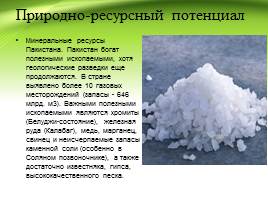
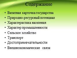
Natural resource potential
Mineral Resources of Pakistan. Pakistan is rich in mineral resources, although geological exploration is still ongoing. More than 10 gas fields have been identified in the country (reserves - 646 billion m3). Important minerals are chromite (Baluchi state), iron ore (Kalabagh), copper, manganese, lead and inexhaustible reserves of rock salt (especially in the Salt Spine), and ample limestone, gypsum, high quality sand.

Population characteristics
Pakistan's population is one of the largest countries in the world. According to some forecasts, with current trends, by 2020 the population of Pakistan could reach more than 200 million people (294 million people by 2100). Religion - Muslim 95% (Sunni 75% and Shia 20%), others (including Christians and Hindus) 5%. The Constitution of Pakistan establishes Islam as the state religion and also provides all citizens with the right to freedom of religion.

Nature of the industry
Mining Industry Manufacturing Industry Automotive Industry

Mining industry
In 1952, the first deposits of natural gas were discovered in Balochistan, but then they were found in Sindh and Punjab. 7 oil fields were discovered. Oil reserves are estimated at 300 million barrels. Other minerals mined include coal, chrome ores, marble, table salt, limestone, uranium, phosphorites, barite, sulfur, precious and semi-precious stones.

Manufacturing industry
The most developed manufacturing industry in Pakistan is textiles, which uses domestic raw materials. In 1980, with the help of the USSR, a metallurgical plant was built near Karachi. There are oil refineries. Small-scale production has been developed - sporting goods and the pharmaceutical industry.

Automotive industry
In April 2005, Pakistan began production of its own REWO car. There is also a KAMAZ vehicle assembly plant in Karachi.

Agriculture
Agriculture remains the backbone of Pakistan's economy. The main agricultural crop is wheat (18.2 million tons)*. Rice (6.3 million tons)* and corn are also grown. The main industrial crops are sugar cane (48 million tons)* and cotton (5 million tons)*. Pakistan has the most extensive irrigation network, irrigating 6.7 million hectares* of land.
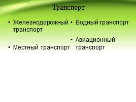
Transport
Rail transport Local transport
Water transport Air transport
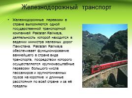
Railway transport
Rail transport in the country is carried out by one state transport company, Pakistan Railways, which is under the authority of the Minister of Railways of Pakistan. Pakistan Railways operates the country's most important mode of transport, through which large-scale transportation of large numbers of passengers and heavy cargo is carried out over short and long distances throughout the country and beyond.
Water transport
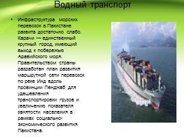
The maritime transport infrastructure in Pakistan is rather poorly developed. Karachi is the only major city with access to the Arabian Sea coast. The government of the country has developed a plan for the development of a transport route network along the Indus River along the Punjab province to reduce the cost of transporting goods and increase employment as part of the socio-economic development of Pakistan.

Aviation transport
There are 151 airports in the country, the largest of which are listed below. Karachi Jinnah International Airport Lahore Allama Iqbal International Airport; Islamabad Benazir Bhutto International Airport; Peshawar International Airport; Sheikh Zayed International Airport Rahim Yarkhan; Quetta International Airport; Faisalabad International Airport; Multan International Airport; Sialkot International Airport; Gwadar International Airport.

Local transport
Buses Scooters Taxi Cars

Attractions
Mountain pass in Pakistan Hill station in Pakistan
National park in Pakistan

Mountain pass in Pakistan
Babusar Pass is a mountain pass in northern Pakistan and the highest point in the Kaghan Valley.
National park in Pakistan
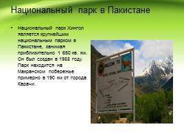
Hingol National Park is the largest national park in Pakistan, covering approximately 1,650 sq. km. It was created in 1988. The park is located on the Makran coast, approximately 190 km from the city of Karachi.
Hill station in Pakistan
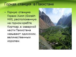
The hill station of Gorakh Hill, located on the Kirthar mountain range, in the northern part of Pakistan is called a lonely, majestic king.

Foreign economic relations
The country exports textiles, ready-made garments, jewelry and precious stones, agricultural and food products, machinery, as well as ore minerals, medicines and other goods. India accounts for 21% of global tea exports. India exports iron ore predominantly to Japan.
In the commodity structure of imports, there is a large share of fuel resources, machinery, equipment, weapons, and lubricating oils.
Code for embedding a presentation video player on your website: