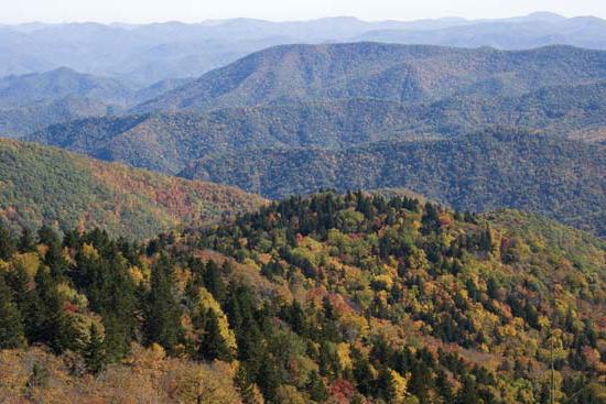
Relief - all this is studied today at school in geography lessons. Knowledge of these topics is necessary not only for passing the exam, but also for overall development. After all, each of us must understand what the surface of the planet on which we live is.
North America, the topography of which we will consider in this article, resembles South America in the type of vertical division. A powerful belt stretches along the western coast for 7000 km. The eastern half of this continent is predominantly flat. All this suggests that the relief of North and South America has significant similarities. However, there are significant differences between these continents. In particular, the Cordillera as a mountain system is much wider and more complex than the Andes (also called the Andean Cordillera). They consist of a whole system of ridges, differing in tectonic and geological structure, which are isolated.
Eastern belt
Five orotectonic longitudinal belts are clearly visible throughout almost the entire length of the Cordillera. The first of them, the eastern one, is the ridges of the Laramie fold: the Mackenzie Mountains, the Brooks Range, the Sierra Madre Oriental Range, the Rocky Mountains. The latter can be divided according to orographic features into two parts: southern and northern. The border between them is the Yellowstone Plateau. The clear straightness of the forms is a striking orographic feature.
Front Range of the Rocky Mountains
The leading ridge of the Rocky Mountains (North America) has the following relief: it stretches for almost 2000 km in a straight line, striking with the continuity, integrity and uniformity of its geological structure. The mountain range, clearly defined, is crowned by steep, high peaks that reach heights of 4000 m. It gradually descends in the east to the Great Plains. The forward ridge in the west is bounded by a tectonic fault in the northern part. In the middle part the mountains are lowered. They are crossed by the Peace River, which is one of the sources of the Mackenzie River. The forward ridge in the southern part is expanding. It is divided into separate ridges, the height of which is significant: Lewis, Caribou, Selkirk. The largest peaks of the Front Range are located in this part. These are Mount Robson (height 3954 m) and Mount Columbia (3747 m). Alpine landforms of North America are typical of the Front Range. It is also characterized by difficult terrain and significant glaciation.
Rocky Mountains in the South
The Rocky Mountains do not form a single mountain range in the southern part. Here they consist of separate massifs, sometimes isolated and separated by “parks” - wide basins, which are plateau-like areas that connect the Great Plains with the Great Basin. Some of the ridges (Sangre de Cristo, Wasatch) stretch almost from north to south. Others (for example, Uinta) - in a west-east direction, perpendicular to them. The significant height and width of this mountain belt compensates for the lack of continuity. The border between and the Rocky Mountains is very clearly defined: a steep wall - a mountain slope. The southern segment is typical epiplatform mountains that were formed after the activation of the edge of one of the ancient platforms.
Belt of internal plateaus and plateaus

The next one is a belt of internal plateaus and plateaus formed in the Nevadan fold on the North American continent. The relief is characterized by folded Nevadan structures represented by peniplains. Within this belt, there are also plateaus that are confined to the “fragments” of the North American ancient platform and are sandwiched by the Cordillera ridges (Northern Massa, Colorado Plateau). The largest intermountain plains are: Fraser, Yukon, Great Basin, Columbia, Northern and Central Mass, Colorado.
Big Pool
The Great Basin is a denudation plateau with the largest area. This territory, whose width reaches 800 km, generally represents an alternation of flat and mountainous surfaces with a predominance of the former. On average, the surface of the plateau is raised by 1500 m. However, there are large fluctuations in heights. The plateau is crossed by parallel ridges with altitudes of approximately 3 km (Wheeler Peak - 3982 m). Deep depressions called bolsons lie between them. These are semi-closed and closed basins, which are areas of internal drainage. Death Valley is one of them (-85 m).

Remnant peaks are often found here (including volcanic cones).
Colorado Plateau and Grand Canyon
This is one of the unique corners of our planet that North America is famous for. Its relief is very beautiful. In its geological structure (undisturbed horizontal plates of mountain sedimentary rocks of different ages - from Upper Paleosian to ancient, lying on a crystalline foundation) this plateau is similar to the North American platform. Its surface is a hilly plain, the heights of which reach 3860 m.
The attraction of the plateau is the Grand Canyon (North America). The terrain and climate attract many tourists to this place. The Grand Canyon (pictured below) was formed near the Colorado River, in its middle course. Its depth reaches 1800 m, with a width of 8 to 25 km at the plateau level and up to 1 km at the bottom level. Sheer slopes of interesting, bizarre shapes are characteristic of the Grand Canyon. They arose as a result of processes of erosion and weathering. A winding narrow channel is cut into the crystalline base.

Inner mountain belt
The third belt - the inner mountain - is the belt of Nevadan ranges: Coast Range, Alaska Range, Cascade Mountains, Sierra Nevada, Transverse Volcanic and Sierra Madre Occidental. These mountain ranges are distinguished by their straightness. Igneous rocks predominate in their structure. - a batholith with volcanic cones set on it. The Sierra Nevada range is an asymmetrical giant crystalline batholith with gentle western slopes and steep eastern slopes.
Synclinorium belt
The fourth belt is the synclinorium belt. This is a subsidence zone that took shape in the Neogene. Part of it is currently represented by various sea bays and straits. On land, this is Death Valley, the Great California Valley, and the lower reaches of the Colorado River.
Extreme western belt
The fifth belt is the extreme western one. This is the coastal belt of such ranges as the Aleutian (there are 25 active volcanoes here), the Kenai Peninsula, the Island Range with Victoria Peak (height - 2200 m), the Chugach Range, the Victoria Peninsula, the Coast Ranges, and the Southern Sierra Madre Range. All of them are classified as medium-altitude, only the most prominent peaks are higher than 2 km.

Depending on the degree of glaciation, the severity of orographic longitudinal belts, tectonic and erosional division, the Cordillera is divided into 4 morphostructural regions: the Cordillera of Mexico, the Cordillera of the USA, the Cordillera of Canada and the Cordillera of Alaska.
Eastern part of the mainland
What is the topography like in the east of North America? Let's figure it out. As we have already noted, the landforms of North America are mostly flat in the eastern part of the continent. These are mainly elevated (Central, Laurentian) and high plains. The lowlands are located along the coastline: the Mexican, Atlantic, Hudson, and Mississippi in the lower reaches of the river of the same name.
Appalachian mountain belt

In North America, unlike South America, another mountain belt stretches along the east coast - the Appalachian. This is a system of mountain ranges located from the Gulf of St. Lawrence to approximately 33-32 0 N. sh., that is, almost 2300 km. is the northern link. The Appalachians are epiplatform, medium-altitude mountains. The significant difference between the southern and northern parts of this mountain system was determined by the features of the tectonic and geological structure. The Hudson Graben is the boundary between the Southern and Northern Appalachians. The northern Appalachians as a whole are undulating plateaus. Individual mountains, ridges or mountain ranges rise above it. The northern Appalachians were covered by the Quaternary glaciation. Therefore, the shapes of the mountains now are flat; only on the highest peaks there are circuses with steep walls.
Southern Appalachians
The Southern Appalachians are distinguished by alternating long parallel valleys and ridges. From the east and west there are plateaus along the foot of the mountains. This is the Piedmont to the west - a denudation flat plain formed by Early Cambrian crystalline rocks. From it in the west, a chain of mountain ranges rises steeply, almost continuous (Kokhuta, Unaka, Cherny, Dymny, Bolshoi, Goluboy, etc.), the height of which is 1-1.5 km. These are “ancient mountains” - dense cores of the Caledonides, prepared by denudation.
Belt of ridges and valleys
One of the most remarkable areas of the Appalachians is located to the west of them. These are the so-called Young Mountains, or the Belt of Ridges and Valleys. Here are some interesting features of the relief of North America. The entire territory is composed of sedimentary rocks from the Paleozoic era: the ridges are shales and sandstones, the valleys are dolomites and limestones. Stretched for hundreds of kilometers from southwest to northeast along the strike line of the mountains, wide valleys alternate with flat-topped or narrow ridge-like ridges. At an altitude of 500-600 m lies the bottom of the valleys. The tops of the ridges reach 1-1.2 km. In tectonic terms, valleys are anticlinoria, and ridges are synclinoria. That is, in this place there is a clear discrepancy with the type of tectonic structure of the modern form that the relief of North America has here. A photo of the Appalachian Mountains is shown below.
This is an example of an inverted or inverted type of relief. It is found quite rarely in the mountains and is most prominently represented in the Appalachians. This type of relief, by analogy, came to be called “Appalachian relief.” The belt of “young mountains” is interrupted from the west by the Appalachian Plateau (Cumberland, Alleghany). It is a ledge, the height of which is 300-400 m. This plateau is significantly higher than Piedmont. Its surface at the eastern edge lies at an altitude of about 1.2 km, and at the western edge - 500 m. The plateau is in some places deeply dissected by the valleys of various rivers (gorges with narrow bottoms and steep slopes).
Well, now that the relief of North America has been briefly discussed in this article, we hope it will be easier for you to form your own idea about it.
North America. Relief and climate. The third largest continent, with an area of 20.36 million km2– entirely located in the Northern Hemisphere. The northern part of the continent is located far beyond the Arctic Circle, and the tropic lies in the south. North America is separated from South America by the Panama Canal, and from Eurasia by the Bering Strait.
The shores of North America are washed by the Pacific Ocean in the west, the Arctic Ocean in the north, and the Atlantic Ocean in the east. The coastline is strongly dissected in the northwest, north and northeast. Coastline elements are: bays– Hudson, Mexican, Californian; peninsula– Florida, California, Alaska, Labrador; large islands– Greenland, Newfoundland, Canadian Arctic Archipelago, Greater and Lesser Antilles, Aleutian Islands.
Relief and geological structure.
The continent's topography is diverse and relatively compact, with mountains in the west and southeast and plains in the north and center. Most of the continental plains were formed on ancient North American platform; a vast flat area in the north formed within the Canadian Shield. The northern parts of the plains have pronounced traces of glaciation - hills, ridges. The chain of the Great American Lakes is like the border of the glacier. To the south are the Central Plains, 200-500 m high, formed by continental and marine sediments. To the west of them are the Great Plains, which are a system of plateaus 500-1700 m high, with a flat surface divided by ledges. They are composed of sedimentary rocks of continental and marine origin. South of the Central Plains is located Mississippian lowlands up to 100 m high. This is a flat plain formed by river sediments bordering the coast of the Gulf of Mexico. The Mississippian lowlands are crossed by numerous rivers flowing from the Central and Great Plains, the Appalachians and the Cordillera.
Appalachia, located in the east of the mainland, are low folded block mountains (up to 200 m) with wide valleys, plateaus and plateaus. The highest point is Mount Mitchell (2037 m). A distinctive feature of the mountains is inversion relief, i.e. the external structure does not correspond to the tectonic structures underlying the relief forms.
The main mountain system of North America is Cordillera stretches along the western edge of the mainland. Highest point - mountain McKinley(6193 m). This folded belt arose at the junction of two lithospheric plates - oceanic and continental. Active processes of mountain building still continue here: frequent earthquakes and volcanic activity. The largest volcanoes are Orizabo, Katmai. There are two chains of mountain ranges in the Cordillera: the Cordillera proper and the Rocky Mountains. The Cordillera proper is a huge arc bordering an oceanic basin; The ridges and plateaus here are crossed by tectonic faults. In the Rocky Mountains, post-volcanic phenomena are observed in the area Yellowstone National Park– geyser eruptions, thermal springs, mud volcanoes. Between the chains of mountain ranges a system of plateaus and highlands is formed: the Yukon Plateau (within Alaska), the Fraser volcanic plateau (within Canada), the Columbia Plateau, the Great Basin, the Colorado Plateau.
Climate.
The diversity of the continent's climate depends on its position at different latitudes. North America is located in all climate zones except the equatorial one. Another important climate-forming factor is the topography of the continent. Meridianally located large mountain systems facilitate the penetration of cold arctic air far to the south and tropical air masses to the north. A continental climate is formed in the interior parts of the continent. The climate is also influenced by ocean currents: cold ones - Labrador and California - lower the temperature in the summer, and warm ones - the Gulf Stream and the North Pacific - increase the temperature in the winter and increase the amount of precipitation. However, high mountains in the west make it difficult for air masses to penetrate from the Pacific Ocean.

Within Arctic climate zone are the northern edge of the mainland and most of the islands of the Arctic Ocean. In winter, temperatures here are very low, snow storms are frequent, and glaciation is widespread. Summer is cold and short, the air warms up to +5 °C. The average annual precipitation is less than 200 mm.
Subarctic climate zone covers the territory between the Arctic Circle and 60° N. w. In the west, the belt extends below the latitude of Moscow. This is due to the influence of the Arctic Ocean, the cold Labrador Current and northeast winds from Greenland. There are oceanic and continental climate types here. In winter, the temperature reaches –30 °C; near the ocean coasts the temperature ranges from –16 to –20 °C. Summer temperatures are 5-10 °C. Precipitation varies from 500 mm per year in the east to 200 mm per year in the west (Alaska region).
Most of the continent is located within temperate climate zone .
It distinguishes three climatic regions:
- region temperate maritime climate in the west of the mainland (the Pacific coast and the western slopes of the Cordillera). Western transport dominates here: winds bring large amounts of precipitation from the ocean - up to 3000 mm per year. The average January temperature is up to +4 °C, the average July temperature is up to +16 °C;
- region located in the central part of the belt. It is characterized by relatively warm summers - from +18° to +24 °C; cold winter – down to –20 °C. The amount of precipitation in the west is up to 400 mm, but its amount increases to the east to 700 mm. The almost open space of this part of the continent is subject to the invasion of air masses from both the north and the south. Therefore, atmospheric fronts are frequent here, accompanied by snow storms in winter and showers in summer;
- region temperate continental climate distributed on the eastern coast of the Atlantic Ocean. In winter, cyclones are frequent here, bringing a lot of snow; temperatures from –22 °C in the north to –2 °C in the south. Summer is not hot – up to +20 °C; The cold Labrador Current exerts its influence. The amount of precipitation varies, depending on the topography and distance from the ocean, but on average it is 1000-1500 mm per year.
Subtropical climate zone located in the area from 40° N. w. to the Gulf Coast. The territory also has a large extent from west to east, so there are differences in climate types and the following climatic regions are distinguished:
- in the West climate subtropical mediterranean with warm and humid winters: temperature +8 °C, precipitation up to 500 mm per year; and dry, not hot summer: temperature +20 °C - the cold California Current has its influence;
- region subtropical continental climate located in the center of the climate zone. Characterized by high temperatures in summer and low rainfall throughout the year;
- region humid subtropical climate covers the Mississippian lowlands. Summer temperatures are up to +30 °C, winters are mild up to +5 °C.

South of 30° N. w. located tropical climate zone , within its borders it is hot all year round. On the east coast of the mainland and on the islands there is a large amount of precipitation brought by the trade winds. The California Peninsula has a dry tropical climate.
Subequatorial climate zone located on the narrowest southern part of the continent. Here, the typical high temperatures throughout the year for this climate zone are about +25 °C. Winds from the Pacific and Atlantic oceans bring a lot of moisture - up to 2000 mm per year.
Sushi waters.
North America has large deep rivers, numerous lakes and significant groundwater reserves. In terms of annual runoff, the continent is second only to South America. The river network is distributed unevenly across the continent, and the rivers have different types of nutrition.
Main river system of the mainland Mississippi with influx Missouri has a length of 6420 km, and carries its waters to the Gulf of Mexico. The river basin includes the Rocky Mountains, Appalachians, Central and Great Plains. The river is full-flowing all year round and has snow and rain types of feeding. The rivers of the Pacific Ocean basin have a steep fall, so they are turbulent and rich in hydropower. Among them are large rivers Colorado(2740 km) and Colombia(2250 km). River Yukon in northwestern Alaska it is full of water in the summer, during the snowmelt period. The largest river in the Arctic Ocean basin Mackenzie 4250 km long, it originates in Great Slave Lake.
Most of the lakes in North America are located in areas that were subject to glaciation. The most unique system Great Lakes- Superior, Huron, Michigan, Erie, Ontario - the world's largest accumulations of fresh water on land. Most lakes have significant depth, for example, Lake Superior is almost 400 m deep. Lakes Erie and Lake Ontario are connected by the Niagara River. Cutting through a hilly ridge, the river falls into the Niagara Falls, 50 m high and 1 km wide.
The largest lakes in North America are also Winnipeg, Great Slave, Great Bear, Athabasca. Residual lakes are preserved in the Great Basin Basin - Great Salt, Utah.
Lesson summary “North America. Relief and climate".
Next topic:
The relief of North America represents all the diversity possible on the planet. Here you can find sultry deserts, multimeter-thick Arctic ice, impenetrable virgin forests and volcanic craters. Each of these phenomena testifies to the long and rich geological history of the continent, the depths of which are still active in the form of active volcanoes and geysers.
Geography of North America
A significant part of the continent is of Precambrian origin, which makes it one of the most geologically ancient regions of the Earth. First of all, this statement applies to the territory occupied by modern Canada.
Such an ancient origin of the continent allows us to define the characteristics of the relief and mineral resources of North America as extremely diverse. The so-called Canadian Shield contains extremely extensive deposits of nickel, copper, zinc, lead, gold and uranium, in terms of reserves of which the country is on a par with Russia and the United States.
The Sudbury field, located in the Canadian province of Ontario, occupies a special place in the topography of North America. This deposit did not appear as a result of a natural geological process, but under the influence of the fall of a large meteorite, which left behind a huge crater.

US territory
Various landforms of North America are represented quite widely throughout the United States. Among professional geologists, it is customary to divide the entire US territory into five large regions, differing from each other in the method of formation and time of origin.
The list of geological provinces of the United States is as follows:
- Canadian Shield.
- Cordillera.
- Stable platform.
- Coastal Plain.
- Appalachian fold belt.
It is worth considering that the provinces stretch over vast distances and, for example, the Cordillera province stretches from Tierra del Fuego in the south to the state of Alaska in the north. At the same time, Hawaii is one of the youngest parts of America geologically, its formation ended a little over two million years ago.
It is worth noting that the relief forms of North America were formed with the participation of a large number of volcanoes, since the entire Cordillera zone is characterized by high volcanic and seismic activity.

Geology of Mesoamerica
Although Central America is classified as a separate region with its own characteristics, from a geological point of view it is an integral part of the North American continent. Volcanoes occupy a special place in the formation of large landforms in North America and the Isthmus of Panama.
For example, the highest point in Central America is the Tajumulco stratovolcano, whose height reaches 4200 meters. It is also worth noting that along the southwestern coast of North America, the terrain is distinguished by a significant number of active volcanoes that formed already in historical times. These include Atitlan, Poas, Irazu and Cosiguina.
In this part of the continent, a description of the relief of North America cannot do without mentioning significant reserves of silver and gold ores. As well as huge hydrocarbon deposits, which are of particular importance in the modern world, especially in the region where their largest consumer is located - the USA.
A feature of the southern part of the relief of North America is the mountainous nature of the area, which affects not only the macroclimate, but also the hydrology of the entire region. Significant elevation changes affect the movement of air masses, which, in turn, provide year-round high water flow due to moisture condensation at significant altitudes.

Cordilleras of North America
The relief of the western part of the United States is formed mainly by a mountain system that stretches along the entire coast for more than nine thousand kilometers. It is impossible to overestimate the importance of this ridge for the climate and nature of the United States. Suffice it to mention such rivers as the Colorado, Rio Grande, Missouri, Columbia and Yukon - all of them have their sources in the Cordillera.
In the mountains, important mineral deposits are developed and timber is harvested. However, tourism in this region can compete with the mining industry in terms of profitability, which includes both sports routes and sightseeing excursions, since many landscapes, such as the Rocky Mountains, are well known to travelers around the world.
It is in the Cordillera that the highest point in North America is located - Mount Denali, whose height reaches 6193 meters above sea level. This peak belongs to the Alaskan mountain range, which forms the northwestern edge of the Cordillera. One of the oldest parts of this mountain belt is the Sierra Madre Southern range, which stretches for almost a thousand kilometers along the southern coast of Mexico.

Great Plains
An integral part of the Cordillera is the foothill plateau, which stretches across Canada and the United States east of the Rocky Mountains. The plateau is called the Great Plains for its vastness, because it extends over the territory of three Canadian provinces and nine American states.
The height of the plains ranges from seven hundred to one thousand eight hundred meters above sea level, and the length of the entire region from north to south is about three thousand six hundred kilometers. At the same time, the width of the plains reaches eight hundred kilometers.
Descriptions of the topography of North America inevitably include mention of the prairies, which constitute the most recognizable part of the Great Plains. The sharply continental climate and steppe vegetation form an environment unsuitable for traditional agriculture, especially for the so-called badlands - poor lands where rocks have undergone significant erosion.
However, industrious settlers managed to establish such efficient wheat production in the area that the Great Plains is now often called the world's breadbasket. Another important component of the region's economy is pastoralism, which is actively developing after the purchase of these lands from France.

Central Plains
West of the Great Plains, in the very depths of the North American continent, are the Central Plains, whose height above sea level does not exceed five hundred meters. The relief of North America shows its diversity even within this geographical region.
The landscape of the plains ranges from lacustrine and outwash in the north to karst and erosional in the south, where the plains smoothly transition into the Mexican Lowland, which defines the geography of the Gulf Coast.
The main rock composing the plains in this part of America is limestone. On the Central Plains there are several ways of its occurrence - horizontally or in the form of gentle slopes. Other minerals that characterize the topography of the North American continent in this part include oil, coal, salt and natural gas.
With regard to hydrology, most of the rivers that drain the plains belong to the basin of the great Mississippi River, which forms the largest river network in North America. Large lakes in the north of the region indicate ancient glaciation, which also had a significant impact on the topography of North America.
Great Lakes
Numerous lakes in the northeastern part of the American continent are one of the most recognizable natural objects of the USA and Canada, without a description of which it is impossible to imagine a story about the large landforms of North America.
The Great Lakes are one of the largest reservoirs of fresh water on the planet, along with Lake Baikal and the glaciers of Greenland and Antarctica. All lakes in the system are interconnected by rivers and canals, and therefore water regularly flows from one lake to another. The lakes are connected to the ocean by the St. Lawrence River, which makes its way through the rocks, forming a picturesque landscape throughout its entire course.
The Great Lakes include the five largest: Superior, Huron, Michigan, Erie and Ontario. All lakes are connected to each other by rivers and canals, and the construction of additional artificial hydraulic structures made it possible to create a transport route more than three thousand kilometers long, along which ocean-going ships can sail.

Geography of Mexico
The entire southern part of the continent is occupied by the Republic of Mexico, which is almost entirely located on the North American plate, which determines the relief of North America in this part of the continent.
The relief of Mexico is formed mainly by two large mountain ranges that cross the country from north to south - the Sierra Madre Oriental and the Sierra Madre Occidental. In addition, the famous volcanic belt, which contains the highest peaks of Mexico, stretches from the west to the center of the country. With a kind of fiery arc, this belt, considered one of the largest on Earth, connects the Gulf of Mexico and the Pacific Ocean.
However, despite the presence of extreme peaks and canyons, most of the country is occupied by the Mexican Highlands, located between the Sierra Madre Oriental and the Sierra Madre Occidental. In its eastern part, the highlands abruptly end off the coast of the Gulf of Mexico, forming picturesque steep banks.
The main part of the highlands has an altitude of one thousand to two thousand meters above sea level and is represented mostly by arid lands. Although the highlands are located in the lower latitudes, which are characterized by a warm climate, its exposure to the cold air masses of the north makes the climate in the region cold and dry in winter. Thus, temperatures in large parts of Mexico can range from -10 to +40.
Greenland
On the opposite side of the mainland, on the Canadian Shield, is the island of Greenland, which from a geological point of view also belongs to North America. Most of the island's territory is covered by an ice sheet that appeared in anthropogenic times.
Since 81% of Greenland's territory is covered by ice, it makes sense to talk about the characteristics of the ice cover. Its average thickness is about 2400 meters, while the maximum reaches three and a half thousand meters.
However, the ice sheet is not a static formation. Under the influence of its own mass and gravity, it moves from the center of the island to the coast, forming so-called outlet glaciers, the speed of which can reach 40 meters per day. When they reach the ocean, glaciers break, forming icebergs.
Alaska
At the northwestern tip of the continent is the Alaska Peninsula, the entire territory of which is occupied by the US state of the same name. Alaska is separated from the Eurasian continent by the Bering Strait, whose width does not exceed 86 kilometers.
One of the most notable landforms of the North American continent in this region is the Novarupta volcano. And also the Valley of Ten Thousand Smokes, which arose in 1912 as a result of a volcanic eruption.
Thus, when characterizing the relief of North America, it is worth saying that all possible forms of landscapes are represented on the continent: from arid deserts to icy wastelands, from the rain forests of the West Coast to the steppe landscapes of the central part of the continent.
Located on two: North American and Caribbean. The larger of them is the North American Plate, on which almost the entire continent is located, as well as islands, including. It should be noted that the western boundary of the plate passes through the territory in such a way that the northern tip of Russia is geologically also part of North America. The Caribbean plate includes the south of the continent, as well as the islands. Tectonic activity is most pronounced here, as there is an active collision of the plate with the North and South American plates.
The northern one can be divided into three parts: the western mountainous, ancient platform and the eastern, related to the ancient folding. The western one was formed mainly in the Mesozoic and includes the Cordillera; some of its sections continue to form today. The platform includes Greenland, the Canadian Shield, Labrador, and the Center of North America. Ancient folding dates back to the Hercynian age and is represented by the Appalachians, the Atlantic and Mexican lowlands.
The most tectonically active areas of America are located in its western part, from the Aleutian Islands to the Isthmus of Panama. Most of the volcanoes are located here, many of them remain active, such as: Momotombo, Tajumulco, Orizaba, Popocatepetl, Colima, Shasta, Rainier, Sanford and Velyaminova volcano in Alaska. There are also a number of tectonic faults in the area, in the area of which there is a constant threat of earthquakes. The most famous of them is the San Andreas Fault. The danger of this fault lies in the fact that large cities of the United States are located next to it - primarily San Francisco and Los Angeles. Destructive earthquakes have already occurred here before, however, over the past decades the cities have grown significantly, so that new ones like these today will lead to colossal destruction. Another dangerous one is the dormant volcano on the territory of the first national park - Yellowstone. Today the volcano manifests itself only in the form of more than three thousand geysers in the park, which is a beautiful and unique natural monument. One of the most famous geysers is the geyser (Old Faithful), which has been erupting on average every 90 minutes for many years (Pictured). However, according to geologists, if the Yellowstone volcano awakens, there will be an explosion greater in power than the eruption of Krakatoa, and the consequences of this eruption will affect the entire planet. Fortunately, such cataclysms occur on Earth no more often than once every few tens of thousands of years. As noted above, the islands of the Caribbean Sea are also characterized by very high seismic activity. The last scary thing
The United States of America is a country located in the Western Hemisphere, on the continent of North America. The USA consists of 48 states bordering each other in the “continental part” and 2 states that do not have a common border with the rest: Alaska - a huge peninsula occupying the northwestern part of the continent of North America, and the islands of Hawaii in the Pacific Ocean.
In addition, the United States includes some territories in the Caribbean Sea (Puerto Rico, US Virgin Islands, etc.), the Pacific Ocean (Eastern Samoa, Guam, etc.) and the non-state District of Columbia.
In the south the USA borders with Mexico, in the north with Canada. The USA also shares a maritime border with the Russian Federation. From the west, the territory of the United States is washed by the Pacific Ocean, from the east - by the Atlantic Ocean, in the southeast of the United States there is the Gulf of Mexico, and the Alaska Peninsula from the north is washed by the Arctic Ocean. Among the US borders, the most common is the so-called geometric (astronomical) type of border. Most of the US border with Canada is of this type (including the Canadian border with Alaska). The eastern part of the US border with Mexico runs along the Rio Grande River. The maritime boundaries along the east and west coasts, as well as the border with Canada in the Great Lakes region, are classified as hydrographic. They were carried out along natural boundaries, taking into account the features of the relief. The western part of the border with Mexico is a straight line connecting two defined points on the ground, while it crosses the territory regardless of the topography, and therefore can be classified as a geometric border.
According to various estimates, the total area of the United States ranges from 9,518,900 square meters. km up to 9,826,630 sq. km, which puts it in 4th place or 3rd place in the list of the largest countries in the world. China has approximately the same area, which varies greatly depending on whether or not various disputed territories are taken into account.
US statistics
(as of 2012)
One way or another, in terms of total area, the United States and China lag behind Russia and Canada, but are ahead of Brazil.
Relief USA
There are several large physiographic regions in the United States. In the east, the Appalachian mountain system stretches along the Atlantic coast. To the west and south of it, the surface levels out, forming low-lying areas through which the largest rivers of the United States flow. Further to the west, the area changes into vast plains and prairies called the Great Plains, which precede the mountainous regions of the Cordillera. Mountain ranges occupy the entire western part of the country and end rather sharply towards the Pacific coast.
Most of Alaska is occupied by the northern Cordillera ranges. The Hawaiian archipelago is a series of volcanic islands up to 4205 m high.
The Appalachian mountain range stretches 1,900 km along the Atlantic coast of the United States from northern Maine to central Alabama. According to other sources, the Appalachian system stretches for almost 3 thousand km. from central Alabama to the island of Newfoundland in Canada, and its width from east to west ranges from 190 to 600 km. The highest point of the system is Mount Mitchell (2037 m), the prevailing heights are 1300-1600 m. These are one of the most ancient mountains on Earth, formed about 400 million years ago, when North America and Europe were part of the single continent of Pangea. The Hudson River divides the system into unequal parts - northern and southern Appalachians. The territory of New England includes the White Mountains, Green Mountains, as well as the Taconic and Berkshire ranges. The southern part includes the Adirondack, Catskill, and Blue Ridge Mountains. The Blue Ridge Range is the highest in the system, divided into two parts by the Roanoke River. To the west of the ranges are the Appalachian Plateaus, consisting of the Allegheny Mountains and Plateau to the north and the Cumberland Plateau to the south. The plateau is 1000 km long and 160 to 320 km wide and is heavily dissected by tributaries of the Ohio River.
The southern part of the system is home to the Great Smoky Mountains National Park. To the south of it is the Piedmont Plateau. The height of the plateau is 150-300 m, sometimes there are low ridges and outcrops. The most famous granite monolith is Stone Mountain with a relative height of more than 185 m.
The Atlantic lowland (width from 160 to 320 km, height up to 100 m) is located between the ocean and the Piedmont plateau, from which it is separated by the so-called “line of waterfalls” - a drop in height, due to which numerous rapids and waterfalls are formed on the rivers. The Atlantic lowland stretches from the Chesapeake Bay to the Florida Peninsula.
To the west from Florida to the Rio Grande River, the entire southern coast of the country is occupied by the Mexican Lowland (altitude up to 150 m). In many places the coast is swampy and has a strip of marshes. Approximately in the middle of the lowland is the Mississippi alluvial plain, ranging from 80 to 160 km wide.
The territory from the Great Lakes in the north and the Mexican Lowland in the south, as well as from the Appalachians in the east and the Great Prairies in the west is occupied by the Central Plains (altitude 200-500 m). In the northern part of the plain, they have a hilly moraine topography, while in the middle and southern parts the hills are flatter and eroded. In southern Missouri, the Ozark Plateau is distinguished, consisting of the Springfield and Salem plateaus and the Boston Mountains (elevation 700 m). South of the plateau across the Arkansas River valley are the Ouachita Mountains, up to 885 m high.
The Great Plains is a strip of steppe between the Central Plains and the mountainous regions of the western United States. Great Plains The Great Plains start from 97-98° west longitude and are essentially the foothills of the Cordillera plateau. The height of the plains increases as you move west from 500 to 1600 m. The plateau is highly dissected, and in some places the network of valleys is too dense for economic use. In the north are the Badlands - “bad lands”, almost devoid of soil cover. To the south are the Sand Hills Mountains in Nebraska. The state of Kansas is home to the low Smoky Hills and Flint Hills, as well as the Red Hills. The southern part of the plains is occupied by the Llano Estacado and the Edwards Plateau.
The North American Cordillera mountain system runs through the western part of the United States, which is a system of parallel ridges stretching from north to southeast and separating them with plateaus, depressions and valleys. The longest chain is the Rocky Mountains (the highest point is Mount Elbert, 4399 m), which includes (from north to south): the Lewis Range, the Absaroka Range and the Bighorn Mountains, the Laramie Mountains, the Sangre de Cristo Mountains and the San Juan, as well as the Sacramento Mountains, which to the south, already in Mexico, pass into the Sierra Madre Oriental range.
West of the northern Rocky Mountains are the Cabinet and Bitterroot Ranges, which extend into the Clearwater Mountains and Salmon River Mountains. The Salmon River is bounded to the south by the volcanic Columbia Plateau and the Snake River Plain, and to the west by the Blue Mountains across Health Canyon. Even further south is the landlocked Great Basin, which is marked by the Independence Mountains, and the upper part of the Colorado River basin, separated from the drainage region by the Wasatch Range and the Uintah Mountains. To the south lies the vast Colorado Plateau, where rivers have carved many beautiful canyons, which is why the region is home to a large number of national parks, such as the Grand Canyon, Bryce Canyon, Arches and Canyonlands.
Along the Pacific coast of the United States there is a series of mountainous Coast Ranges (altitude up to 2400 m), which include the Alaska Range, ranges in Canada, the Cascade Mountains, the Sierra Nevada and the Sierra Madre Occidental range in Mexico. Between the Coast Ranges and the Cascade Mountains lies the fertile Willamette Valley. The Sierra Nevada range contains the highest point in the continental United States - Mount Whitney (4421 m). Between this range and the Coast Ranges lies the California Valley, consisting of the San Joaquin River valleys to the north and the Sacramento River to the south. East of the Sierra Nevada range is the small White Mountains range and beyond it Death Valley. In southern California, the Santa Rosa Mountains border the Imperial Valley, bounded on the east by the Sonoran Desert.
Most of the territory of the state of Alaska is occupied by mountain ranges stretching from west to east. The northern part of the state is occupied by the flat Arctic Lowland, framed to the south by the Brooks Range, which includes the DeLong, Endicott, Philip Smith and British Mountains. In the central part of the state is the Yukon Plateau, through which the river of the same name flows. The Aleutian Range arcs around the Susitna River valley and continues as the Alaska Range, forming the Alaska Peninsula and the Aleutian Islands. The highest peak in the United States, Mount McKinley (6193 m), is located on the Alaska Range. Along the US coast of the Gulf of Alaska stretch the Chugach Range, the St. Elias Range and the Wrangel Mountains.
US water resources
Map of average annual precipitation in the continental United States For more information, see also: List of rivers in the United States, List of lakes in the United States Rivers flow from the United States into the basins of three oceans - the Pacific, Atlantic and Arctic. The main watershed (between the Pacific and Atlantic oceans) runs through the eastern part of the Cordillera, and only a small part of the territory of the northern states and Alaska belongs to the Arctic Ocean basin. The meeting point of the three watersheds is located at Triple Divide Peak.
According to TSB, the average annual runoff from the surface of the main part of the United States is 27 cm, the total volume is 1600 km², and the regime of most rivers is irregular, especially in continental regions. The provision of water resources in different parts of the country is uneven - the height of the annual runoff layer in the states of Washington and Oregon is 60-120 cm, in the east (in the Appalachian region) 40-100 cm, on the Central Plains 20-40 cm, on the Great Plains 10-20 cm , and on internal plateaus and plateaus up to 10 cm.
Large lakes are located in the north of the country - the Great Lakes. Smaller, endorheic salt lakes are found in the depressions of the Great Basin. Inland water resources are widely used in industrial and municipal water supply, irrigation, hydropower and shipping.
The largest system of freshwater lakes in North America, in the United States and Canada, connected by rivers and canals. Area approx. 245.2 thousand km?, water volume 22.7 thousand km?. The great lakes themselves include the five largest: Superior, Huron, Michigan, Erie and Ontario. Among the smaller ones: St. Marys, St. Clair, Nipigon. The drainage from the lakes occurs through the St. Lawrence River.
Many rivers flow into the Atlantic Ocean from the eastern coast of the United States, the longest of which originate in the Appalachians and are several hundred kilometers long. The Hudson, Potomac, James, Roanoke, Great Pee Dee, Savannah, Altamahoe and other rivers flow through the Atlantic Lowland.
The southern part of the lowland is located in Florida - there are the famous Everglades, the Big Cypress swamp, and many karst and lagoon lakes, the largest of which is Okeechobee.
Most of the US river flow belongs to the Gulf of Mexico basin of the Atlantic Ocean. This drainage basin extends west to east from the Rocky Mountains to the Appalachians and from the Canadian border to the north. The largest river system is formed by the Mississippi River (length 3757 km, annual flow 180 km?) and its countless tributaries, the largest of which are the Missouri (length 4127 km), Arkansas (2364 km) and Ohio (1579 km). The Mississippi Delta is located in the center of the Mexican Lowland and extends more than 100 km into the Gulf.
Rivers such as the Rio Grande, which runs the eastern part of the border between the United States and Mexico, as well as the Colorado, Brazos, Trinity, and others flow directly into the Gulf of Mexico. There are several drainage-free areas in the United States, the largest of which is the Great Basin. Its territory includes the Great Salt Lake, Utah and Sevier lakes in the east, as well as a number of small lakes in the west: Honey, Pyramid, Winnemucca, Tahoe, Walker, Monet and Owens. The drainless Humboldt River also flows through this basin. Also notable are the Great Divide Basin and the Harney Basin, which contains Lake Malur.
The Columbia River (2250 km long) with its tributary the Snake (1674 km) forms the largest basin in the northwestern United States. Colombia has an annual flow of 60 km? and has the largest hydroelectric potential. The Franklin Roosevelt Reservoir is located on the river near the border with Canada. A southern tributary of the Columbia, the Willamette River flows through a valley that is called the northern analogue of California. The San Joaquin and Sacramento rivers flow through the California Valley itself, which together flow into San Francisco Bay.
Another large basin in the western part of the country is formed by the Colorado River (2330 km), flowing on its way through the world's largest Grand Canyon. Above this canyon is the large Powell Reservoir, below is the Mead Reservoir. The Colorado flows into the Gulf of California in Mexico.
The largest river in Alaska, the Yukon (3,700 km), as well as the Kuskokuim River, flow into the Bering Sea bay of the same name. Only a small part of the United States territory belongs to the Arctic Ocean basin. The northern regions of Minnesota and North Dakota are dented by rivers, the flow of which is directed through Lake Winnipeg and the Nelson River into Hudson Bay. In addition, the rivers of northern Alaska, such as the Noatak and Colville, also carry their waters into the northernmost ocean of the planet.
USA climate
Climate zones of the continental United States. Due to the large size of the country, its length, and the wide variety of geographic features, areas with almost any climatic characteristics can be found throughout the United States. Most of the United States (states located north of 40 degrees N latitude) is located in the temperate climate zone, to the south the subtropical climate prevails, Hawaii and the southern part of Florida lie in the tropical zone, and northern Alaska belongs to the polar regions. The Great Plains west of the 100th meridian are classified as semi-deserts, the Great Basin and the areas around it have an arid climate, and coastal areas of California have a Mediterranean climate. The type of climate within the boundaries of one zone can vary significantly depending on the topography, proximity to the ocean and other factors. The favorable climate had a significant influence on the settlement of the continent by Europeans and largely contributed to the United States taking a leading position in the world.
The main component of the US climate is the high-altitude jet stream - powerful air currents that bring moisture from the north Pacific region. Moisture-laden winds from the Pacific Ocean actively irrigate the western coast of the United States. In the northwest, rain is common throughout the year, and more snow falls in winter than anywhere else in the world. Located further south, California receives most of its precipitation in the fall and winter, but in the summer it is quite dry and hot, which forms its Mediterranean climate. The Cascade Mountains, Sierra Nevada and Rocky Mountains absorb almost all the moisture, leaving a rain shadow to the east that forms a semi-desert climate in the western Great Plains. Death Valley and the Great Basin deserts were also formed due to the presence of this shadow. The dry winds of the high-altitude jet stream, hitting the completely flat Great Plains, are no longer obstructed and pick up moisture again.
Encounters with saturated flows from the Gulf of Mexico often result in severe storms and thunderstorms. In winter, they cause intense snowfall on the northeast coast of the United States. Often the vast flat plains of the United States are the cause of extremely rapid, sometimes catastrophic, weather changes. Temperatures can rise rapidly and also rapidly fall, depending on which air masses are “captured” by the high-altitude current - from cold Arctic ones in the north to warm tropical ones over the Gulf of Mexico.
Natural disasters
A relatively large number of different natural disasters occur in the United States each year.
On the one hand, droughts rarely occur in the United States, but on the other hand, when they do occur, they have serious, sometimes catastrophic, consequences. As an example, we can recall the terrible drought of 1931-1940, also known as the Dust Bowl, which also occurred during a period of severe economic crisis - the Great Depression. Farms in the Great Plains region virtually ceased to function, the region became depopulated (up to 2.5 million people left the plains by 1940), and numerous dust storms destroyed the top fertile layer of soil. In 1999-2004, America experienced another drought, comparable in consequences to the one described above.
Frequent tornadoes are a well-known feature of the North American climate; in fact, the US far outstrips any other country in the number of tornadoes. The collision of air masses with widely varying temperatures is the main cause of frequent thunderstorms and tornadoes in the central United States during the spring and summer. Although tornadoes in America occur in a variety of regions - in the lowland regions of Canada, on the east coast of the United States and on the Florida peninsula, the most frequent and powerful tornadoes occur in the so-called Tornado Alley, the conditional boundaries of which cover northern Texas, Oklahoma, Kansas , parts of Missouri, Arkansas and Tennessee. In the cities of these states there are special sirens warning of the appearance of a tornado, and houses are equipped with tornado shelters even during construction.
Another natural disaster that often occurs in the United States is hurricanes. The East Coast, the islands of Hawaii and especially the southern US states bordering the Gulf of Mexico are most susceptible to this disaster. Hurricane season in the United States begins in June and ends by early December, with the peak period from August to October. The most destructive hurricanes include the Galveston Hurricane of 1900, Hurricane Andrew of 1992, and the terrible Hurricane Katrina, which swept through the southern United States in 2005. On the west coast of the United States, echoes of Pacific typhoons are sometimes observed, most often in the form of heavy, prolonged downpours.
Floods, like droughts, are not frequent occurrences in the United States. However, it is worth noting the Great Mississippi Flood of 1927 and the Great Flood of 1993 - extremely long and severe floods that claimed many lives and cost the American economy dearly. Many floods are also a direct consequence of hurricanes. Of particular note are floods that develop extremely rapidly due to the topography of some areas of the United States. A sudden thunderstorm can instantly fill the canyon, raising the water level by several meters at once. In the state of California, landslides also regularly occur due to heavy rains.
The west coast of North America is part of the so-called Pacific Volcanic Ring of Fire - the source of 90% of all earthquakes on earth. The entire mountainous region, from the Alaska Peninsula to southern California, is a zone of increased volcanic activity. The concentration of volcanoes is especially high in the Cascade Mountains in the northwestern United States. The 1980 eruption of Mount St. Helens was one of the most destructive in the United States. The islands of Hawaii are also famous for their volcanoes; for example, the Kilauea volcano has been erupting continuously since 1983. However, Hawaiian volcanoes do not pose a particular danger to residents of the state. The states of Alaska and California, due to their location on the edge of the Ring of Fire, are prone to particularly strong earthquakes. The 1906 San Francisco earthquake and the 1964 Alaska earthquake were among the strongest in history. Apart from large destructive earthquakes, these states experience smaller shocks quite regularly, so all buildings have to be built earthquake-resistant. Direct consequences of earthquakes are also tsunamis, which often hit the western coast of the United States.
Recently, due to dry summer periods, the state of California suffers from forest fires every year.
Statistics
Arctic conditions prevail in the tundra of northern Alaska; the minimum temperature recorded in these parts was -62 °C. The highest temperatures in the United States were recorded in Death Valley in California, the thermometer there rose to 56.7 °C, which is only a degree less than the world record recorded 9 years later in the Sahara.
The Western United States is known for its snowfall, with much more snowfall on average than anywhere else on earth. In the winter of 1998-99, about 29 meters of snow fell at one of the ski resorts in Washington state. The rainiest place in the United States is Hawaii; the island of Kauai receives 11,684 mm of precipitation annually. In the Mojave Desert, on the contrary, the amount of precipitation is extremely low - an average of 66.8 mm per year.
The highest point in the United States is Mount McKinley in Alaska, its height is 6194 m (according to USGS). Lowest - Death Valley, Inyo County, California (-86 m).
US flora
Various climatic zones pass through the territory of the United States, and in some corners of this vast country a truly unique microclimate has developed, in which an amazing flora has formed.
Of course, the economic development of the North American continent played a role, but quite large areas, about 30%, are currently covered with forests. Mainly coniferous species predominate - spruce, pine, fir. In the northeast of the country there are tracts of mixed forests, where, in addition to coniferous trees, oaks, maples, plane trees, birches, ash trees, and sycamores grow. The Mojave Desert also has peculiar forests - cactus forests. In Alaska, the northernmost state of the United States, only mosses and lichens grow, in deserts and semi-deserts - shrubs, yucca, wormwood, quinoa, in alpine and subalpine meadows - heather and other flowering plants. Closer to the south there are magnolias and rubber plants, on the Gulf Coast there are mangrove forests, on the west coast there are citrus trees, and in Hawaii there are tropical jungles with palm trees, vines, orchids and other exotic representatives of the flora. The vegetation of national parks and reserves is also unique. Yellowstone National Park, which has been in existence for over 130 years, is home to 1,870 plant species, the vast majority of which are native species.
Most of the park's forests are occupied by lodgepole pine. Also among the conifers one can note Douglas fir, whitebark pine, Menzies pseudo-hemlock, and Weymouth mountain pine. Deciduous trees grow in the undergrowth: birch, willow, aspen. Only in Yellowstone National Park can you find sand-loving abronia and grass agrotis. The Everglades National Park contains more than 2,000 species of plants (various types of mangroves, mahogany, oaks, willows, cypresses, pines, ficus, inkwood, etc.). Also here, tropical swamps with 25 species of orchids have been preserved in their original form.
Zion National Park has mixed and coniferous forests, desert and coastal vegetation - a total of 450 species. Yosemite National Park is home to 1,600 plant species, of which 160 are endemic. Next to it is Sequoia Park, where the tallest trees in the world grow. The tallest sequoia, called Hyperion Height, is 115.5 meters high. The world's northernmost stretch of rain forest is located in Olympic National Park. It is also the wettest area in the mainland United States.
Wildlife of the USA
The rich fauna of the United States is mainly due to the vast expanses and careful protection of nature, which has already suffered many troubles from humans.
Although the fauna of the United States has some similar features to that of Europe, the North American continent also has its own unique animals. Animals common to Eurasia include deer, elk, wolves, hares, sables, ermines, wolverines, woodpeckers, owls, etc. Unique North American animals are porcupines, martens, great flying squirrels, red squirrels, etc.
The nature of the animal world is mainly determined by climatic conditions and vegetation. Black bears (baribals) and grizzly bears, Virginia deer, red lynxes, cougars, opossums, skunks, and chipmunks are common in deciduous forests. Brown bears, lynxes, martens and wolverines live in mixed forests. In Alaska, seals and walruses establish rookeries. In the steppes, in addition to large artiodactyls (bison, deer, pronghorn antelope, bighorn sheep), there are foxes, coyotes, badgers, and ferrets. Bison were mercilessly exterminated by humans for their valuable skins, but are now protected by law. Deserts are inhabited mainly by small mammals (marsupial rats, etc.), reptiles (snakes, lizards, iguanas), as well as insects (scorpions, spiders, etc.). The tropical forests of the Gulf Coast are home to crocodiles and alligators, as well as anteaters, arboreal porcupines, and marmosets. Nutria, muskrats, beavers, as well as amphibians such as frogs, toads, and newts live in reservoirs.
The birds found in the United States are very diverse. In mid-latitudes you can watch owls, vultures, eagles, mockingbirds, cranes, snipe, peregrine falcons, and cormorants. In the south of the country there are more exotic species - parrots, flamingos, pelicans, hummingbirds.
The fish world is mainly represented by salmon - there are 18 species in the Yellowstone Nature Reserve alone. Near the Hawaiian Islands, 600 species of tropical fish coexist with turtles.
Vast national parks and reserves help preserve the enormous diversity of wildlife in the United States. The greatest species diversity of mammals, birds, fish and insects can be found in Yellowstone, Everglades, Zion (about 300 species of birds), Bryce Canyon (60 species of mammals and 160 species of birds), and Santa Ana (the largest bird sanctuary) national parks. The world-famous Yellowstone Wildlife Refuge is home to the world's largest populations of bison, grizzly bears, pumas and wolverines. In the Everglades National Park, where tropical swamps have been preserved, Mississippi alligators and sharp-snouted crocodiles coexist, as well as numerous species of birds, including exotic ones.